Photo Library
Map: Plan of New Port Adelaide, 1840-41
Hover or tap the map below to zoom in
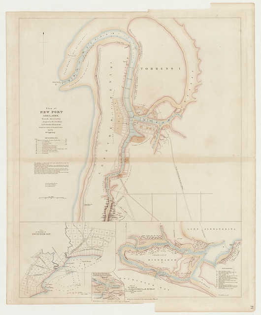
Plan of New Port Adelaide, South Australia : designed by His Excellency Col. G. Gawler, K.H. &c &c. &c. divided into sections of 80 and 134 acres / Survd. by Wm. Light esqr
Cadastral map with notes on vegetation and landform.
Insets: Chart of the outlet of L. Alexandrina or R. Murray / by J. W. L. Pullen Esqr., Comr. R. N. 1840 -- The sea mouth of the R. Murray / by J. W. L. Pullen Esqr. Commr. R.N. 1840 -- Plan of sections at Encounter Bay.
View more information at State Library of South Australia