Photo Library
Map: Country south of Adelaide, 1840
Hover or tap the map below to zoom in
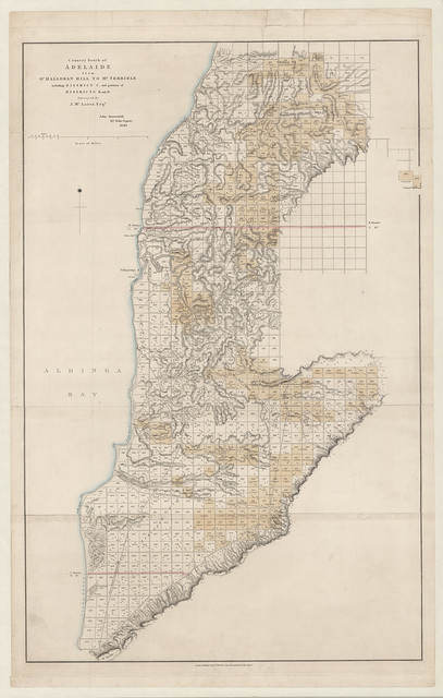
Country south of Adelaide from O'Halloran Hill to Mt. Terrible including District C and portions of Districts B and D.
Shows land sections in Section C, north of Port Noarlunga to Aldinga Bay, and eastwards to the Willunga hills part of the Mount Lofty Ranges, including the section 258 on which Willunga was settled. Also includes part of Section B on the north side, from O'Halloran Hill, and Section D on the south, to Sellicks Beach.
View more information at State Library of South Australia