Photo Library
Map: Plan of the City of Adelaide, 1837
Hover or tap the map below to zoom in
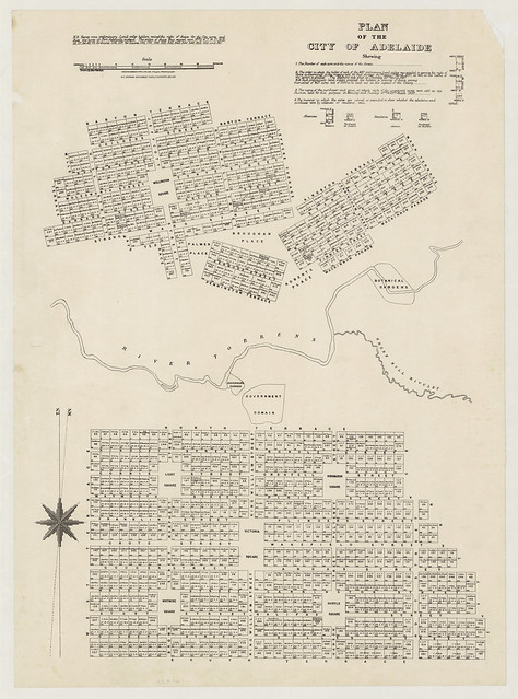
Plan of the City of Adelaide shewing...
[Adelaide, S. Aust.] : M.E. Sherrah, Government Photolithographer, [1948-1953]
Reprint of 1890 - 1900 edition.
Cadastral map of Adelaide based on the original plan by Colonel William Light, produced in 1837. It is a reprint of the 1890-1900 edition published: Adelaide : Surveyor General's Office, A. Vaughan Photolithographer. The publishing date has been taken from M.E. Sherrah's term of office as Government Photolithographer
View more information at State Library of South Australia